Pic d’Issarbe F/PO-171 (4 points)
I’d done the Pic d’Issarbe on my last trip to the Pyrenees, and it’s a lovely, easy four-point walk at this time of year. The site is a minor ski resort in the winter and as such has a car park which was almost deserted on this September morning.
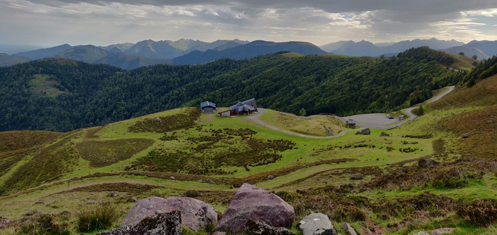
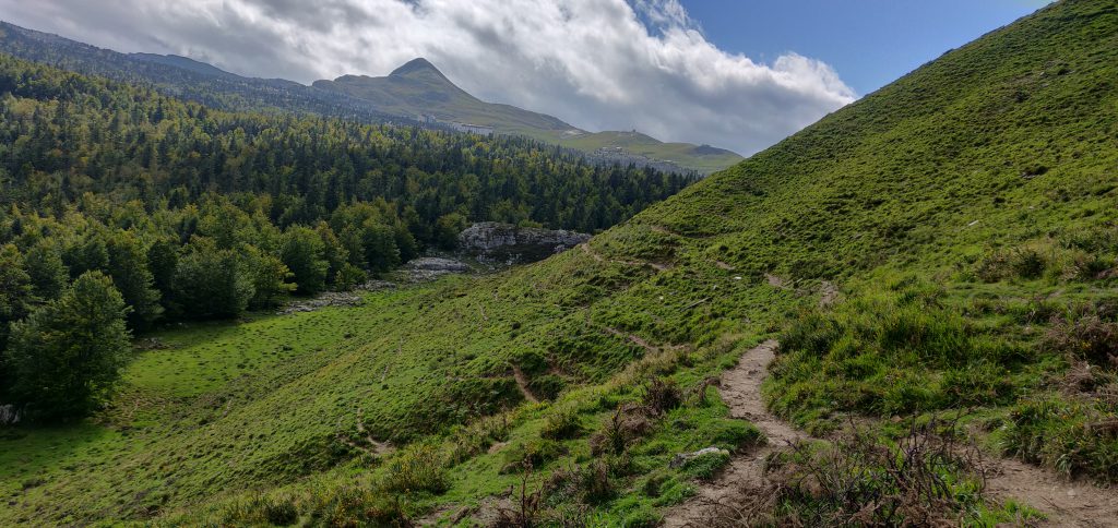
The ascent up the hill is simply a matter of choosing one of the many ski-run paths and following it to the top. The summit itself is marked by a small metal cross and there’s a reasonable amount of space within the activation zone for an HF dipole, even though the terrain slopes away quite quickly. It was a very pleasant morning and I was slightly ahead of my schedule, so I made 28 QSOs on 30m CW before descending.
The ascent took me 25 minutes for a climb of about 160m vertically over only just over a kilometre horizontally on the wide, grassy, paths. The descent took a little less.
Total climbing: 238 m
Total time: 01:46:22
Pic de Guilhers F/PO-283 (4 points)
For the Pic de Guilhers, I opted to follow EA2EEB’s track from the SOTA Mapping website, which starts from the car park at the Pierre St Martin ski resort. This was not the best idea but more on that later.
Under usual circumstances, the car park is only about 20 minutes’ drive from the Pic d’Issarbe, which is why I’d opted to do both mountains on the same day. However, I hadn’t allowed for meeting a large flock of sheep which surrounded my car and I spent several minutes inching forwards trying to follow the road without herding them.
The other reason that the Pierre St Martin car park is not ideal is that it means you start the climb from higher than the summit. The walk starts with a steep descent down a rocky gully at the side of the road to reach the valley floor, before you have to ascend the hill itself. A preferable option would have been to start from the car park at 42.9849,-0.7429, which would have saved a chunk of the walk.
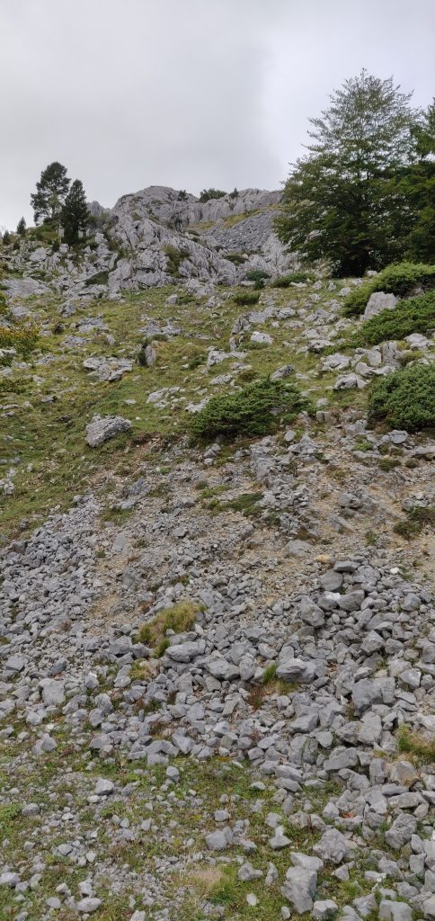
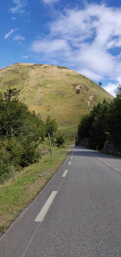
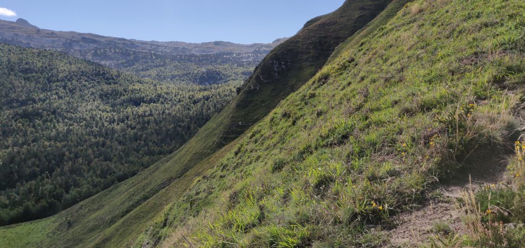
Once at the bottom of the gully, you follow a couple of ski runs to join the main D132 for about a kilometre before leaving the road again. This is some pretty boring walking on tarmac, still heading downhill, but you soon get your first proper sight of the Pic de Guilhers and the challenge it represents.
As you can see, the mountain is a steep ‘pudding bowl’ with apparently no path up it. As you get closer, you see that there are many paths that actually skirt around the bottom of the hill – some may be animal tracks others caused by erosion – and intuitively I initially tried to pick my way up to the highest of these to gain some high and then go up from there, again following EB2EEB’s GPS track. I found it just too step, however, and fearful of sliding down the hill I decided to continue around the side of the mountain. It looked like there might be a slight shoulder behind the hill.
My map reading was right. I’d recommend that you actually follow one of the middle paths around the side of the mountain without worrying too much about gaining height at first. Once you have skirted around the side, aim for 42.9931, -0.7330 and then follow the narrow path to where the trees meet the side of the mountain at 42.9948, -0.7326. From here, it’s a relatively easy ascent through the heather to the summit.
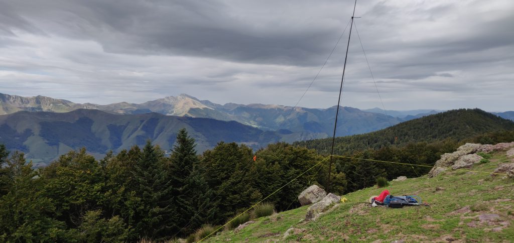
Once you are at the top, it’s fairly flat, and there’s plenty of room to set up a wire antenna. Sadly, conditions weren’t great, so I only made 10 QSOs from here on 30m CW before packing up.
As you might have gathered, this is a bit of a beast of a hill for just four points. Not only did I park higher than the summit and have to walk downhill to start the ascent, but I lost a lot of time trying to pick the right path on the ascent and tryign to gain height prematurely, only to have to carefully pick my way along steep, narrow paths. Consequently, the climb took me 1 hour 20 minutes to walk 3.85km horizontally, and ending up 30m lower than the car park where I had started, but still 160m above the valley floor below. The descent took only ten minutes less, and was exhausting with the final climb back up the gully to the car park. With that, I headed the 2h30m to my hotel in St Jean de Luz, from which I’d go up Xoldoko Gaina tomorrow.
Total climbing: 700 m
Total time: 03:10:27


