I’ve recently returned from a few days in the Basque Country, which included a few summit excursions. Although I’m aware that I’m behind on writing up some of my other SOTA trips over the summer, I’ve decided to type up my notes on this recent trip first before I forget the detail.
Aratz EA2/VI-003 (6 points)
Having landed in Bilbao, Spain, I hired a car and drove for about 90 minutes to the car park which serves both Aratz (EA2/VI-003) and also Aitxuri (EA2/SS-001). The car park itself is located near the end of the GR-282 road at 42.9351, -2.3032. The GR-282 itself is a concrete road but perfectly decent to drive over.
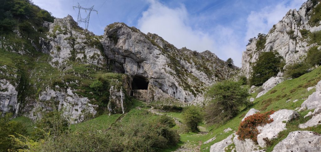
From the car park, you head on the path through the trees and over the bridge. The path soon opens out to a wider area, but it is obvious and without any particular navigational challenges. Note only that at this point you are heading away from the summit – this is because the summit itself is above a steep cliff face, and so the path heads around the side in order to reach a shoulder where the access is easier.
At 42.9352, -2.3153 you reach the fascinating natural tunnel through the ridge which contains a chapel at the site of a former hermit’s dwelling, the San Adrian’s hermitage.
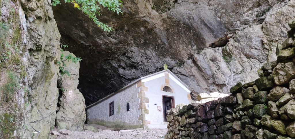
Continue walking through the tunnel but be wary of where there are drips onto the well-worn cobbles – the stones were quite slippery in places.
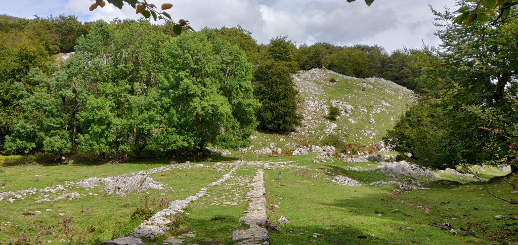
After the tunnel continue on the main path and where the route splits follow the white and red paint markings to the left, signposted to Gazlaren Ibilbidea. This brings you to another fascinating feature of the walk – an intact Roman road taking you back into woodland.
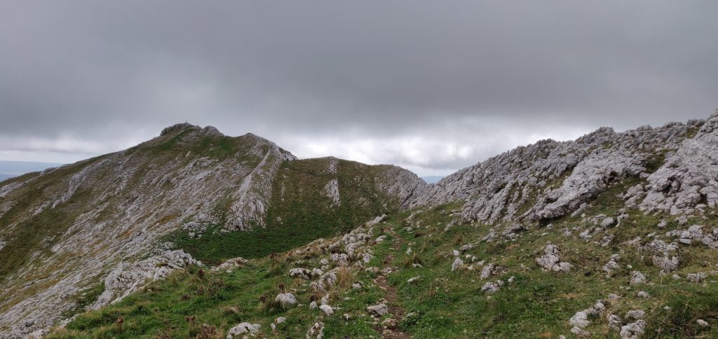
Shortly after you’ve picked up the Roman road, watch for where the road bends around to the right and look for a small, muddy track through the trees straight ahead of you, marked with yellow dots of paint. This is the route to the summit of Aratz.
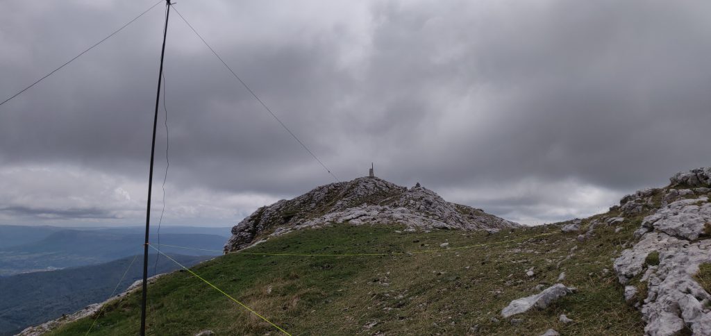
Once back out of the trees, you are almost at the summit. The path is narrow but it’s not near the edge and it felt perfectly safe. This final section is the steepest and there’s a misleading false summit to get over before you see the final destination, marked with a trig point.
Having reached the trig point, there is a fairly large area, though sloping, that’s within the SOTA activation zone where you can set up an antenna.
On a clear day, the summit of Aratz would have a stunning view out to the Bay of Biscay to the North and across the plains of the Ebro valley to the South. As such, the radio takeoff was pretty impressive and I was pleased to make 13 contacts on 30m CW within about 10 minutes.
The ascent (about 580m vertically over 4.4km horizontally) took me 90 minutes and the descent would have taken a little less had I not stopped for lunch. This wasn’t a hard climb and was a very interesting walk.
I had originally planned to go on to EA2/SS-001, since the walk there only diverges from the path to Aratz after San Adrian’s hermitage. However, with a long drive into France still ahead of me and having started slightly later than I had hoped, I decided to head straight back to the car.
Total climbing: 1026 m
Total time: 03:44:09


