I’ve recently returned from what has become an annual tradition of spending Easter weekend away climbing hills for SOTA. Last year (and admittedly Easter was earlier), the Beast from the East had just hit and I was walking through snow on Pen-Y-Fan. This year, the weather was completely different with bright sunshine, hardly any wind, and 20C temperatures.
Having driven to Wales after work on Maundy Thursday evening, I stayed the night in the Premier Inn at Llandudno Glan-Conwy, which is ideally situated on the A55. This was a deliberate choice as I knew the carpark at my first target fills up quickly, so I wanted to make an early start on Friday morning. The target was to do the circuit up Y Garn (8 points) and along the ridge to Glyder Fawr (10 points), then descending on the Devil’s Kitchen path.
Car park to Y Garn (GW/NW-004)
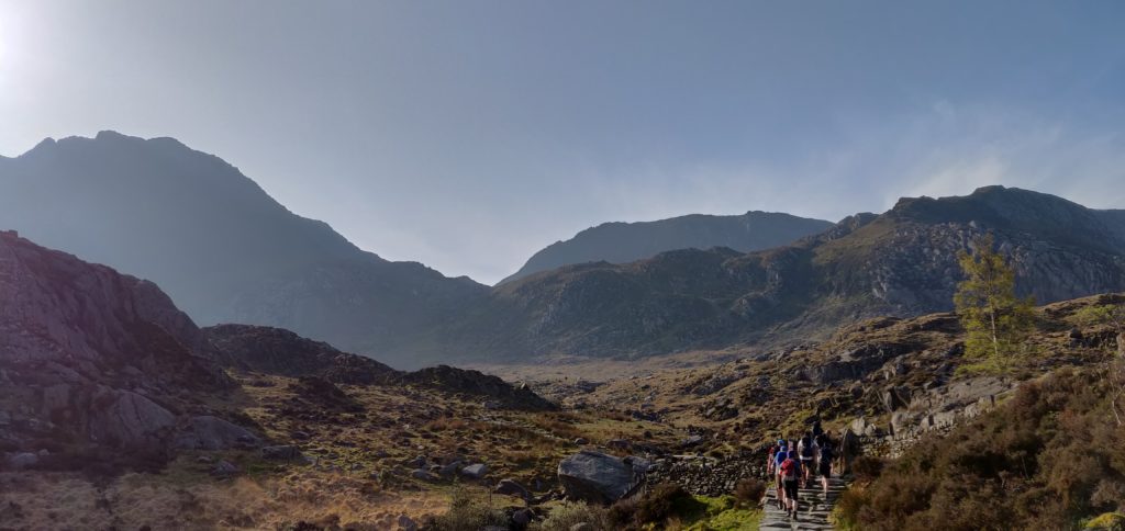
As was my intention, I was lucky to be early enough to get one of the last few spaces in the car park near Ogwen Cottage on the A5 (Currently £6 for the day or £3 for four hours, proceeds going to the National Park.) Having said that, there is ample parking along the A5 if the car park is full.
From here, the route from the car park to the summit of Y Garn is an obvious one. The well-made stone path rises slightly to Llyn Idwel lake. At this point, the route splits and the main path goes along the left (Eastern) side of the lake. You will be coming back that way, so you need to follow the fainter track, initially along the north shore of the lake.
Once the path has left the lake, it soon starts to rise along the edge of Y Garn. The route is steep in several places but not especially dangerous or difficult and the path is clear.
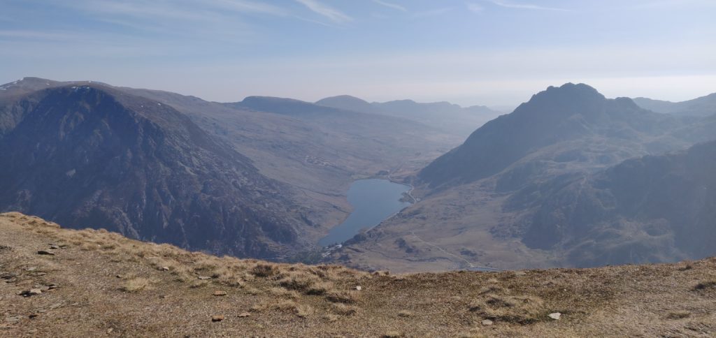
From the ascent, you can look down to the Ogwen valley floor where you started. It’s a fantastic view.
The ascent of Y Garn from the car park took me exactly two hours, having started at 9am. It’s a 2.17 mile / 3.5km walk, ascending 647 metres (and most of this ascent is after Llyn Idwel).
On this Good Friday morning. the summit was quite busy and so I quickly made a eight contacts on 2m FM from just my handheld and left it there without unpacking the HF gear. On such a nice Easter weekend, I probably shouldn’t have been surprised that there were lots of SOTA activators around but I made 3 summit-to-summit contacts from here – a theme that was to continue through the rest of the weekend.
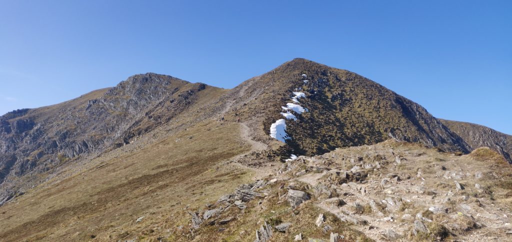
Y Garn to Glyder Fawr (GW/NW-003)
Y Garn is connected to Glyder Fawr by a ridge, so you only have to drop 250m from the summit of Y Garn to a lake on the col (Llyn y Cwn at 710m ASL) before climbing back up 300m to the 10-point Glyder Fawr. You don’t have to go all the way back down to the valley!
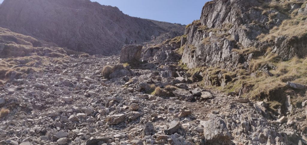
From the summit of Y Garn is just a matter of walking downhill over the grass towards Glyder Fawr. There are a few paths to choose from. The path up Glyder Fawr is somewhat more strenuous, as it climbs steeply over loose slate and other rubble.
This section of the walk took me 70 minutes to walk the 1.7 miles / 2.73 km between the hills. Unfortunately, somewhere approaching the summit I lost my sun hat, which was annoying in the hot weather.
In trying to retrace my steps to locate – in vain – my hat and also with some slight concern about the descent of Devil’s Kitchen (which I’d forgotten since I last did it over 10 years ago), I decided to make this a quick activation as well and just made six QSOs on 2m from the handheld before heading back to the valley floor.
Glyder Fawr to the car park
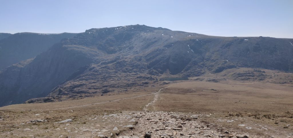
From Glyder Fawr’s summit, you descend to Llyn y Cwn via the same stony path you used for the ascent but at the lake you turn north-west, following the obvious path towards Devil’s Kitchen.
The Kitchen itself is a flat face of rock used by rock-climbers which, on some days ‘steam’ can be seen emanating from. Luckily, us walkers don’t have to cope with such things as there’s a path that runs alongside the Kitchen, known as the Devil’s Kitchen path. It’s a little narrow in places and I had to use my hands to ease myself down in a couple places but it’s perfectly manageable and, on a day like today, well-frequented.
Once you are down the path from the Kitchen, you can follow the obvious route around to the right-hand side of Llyn Idwel and the back to the carpark.
The descent from the summit to the car park took me 2 hours 45 minutes for the 3.87 miles / 6.22 km, losing 627 metres (mainly through the Kitchen).
Total climbing: 2131 m
Total time: 06:36:44
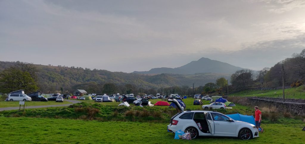
By now, it was late afternoon and so I headed to the Dolgam campsite, where I have stayed before, to pitch my tent for the next two nights. It’s a beautiful location on the A5 near the foot of Moel Siabod (a SOTA which is still on my to-do list). I wanted to be up early to attempt Carnedd Llewelyn and Pen Llithrig y Wrach tomorrow.


Pingback: Snowdonia SOTAs 2019: Pen Llithrig y Wrach (and a failed attempt of Carnedd Llewelyn) | Dom Smith