Last week I spent some time on a family holiday in Madeira, during which I also spent three days in the hills doing SOTA activations.
The first thing to know about Madeira from a radio perspective is that although the DXCC prefix is CT3, that prefix is reserved for residents. The prefix authorised for CEPT visitors is CT9.
Pico Ruivo do Paul (CT3/MI-006)
The six-point Pico Ruivo do Paul is about 45 minutes drive from Funchal, along fairly quiet roads. I parked our hire car at the parking space off the road at 32.7699N, 17.0782W. Nobody else was around, as this isn’t the most frequented area of the island.
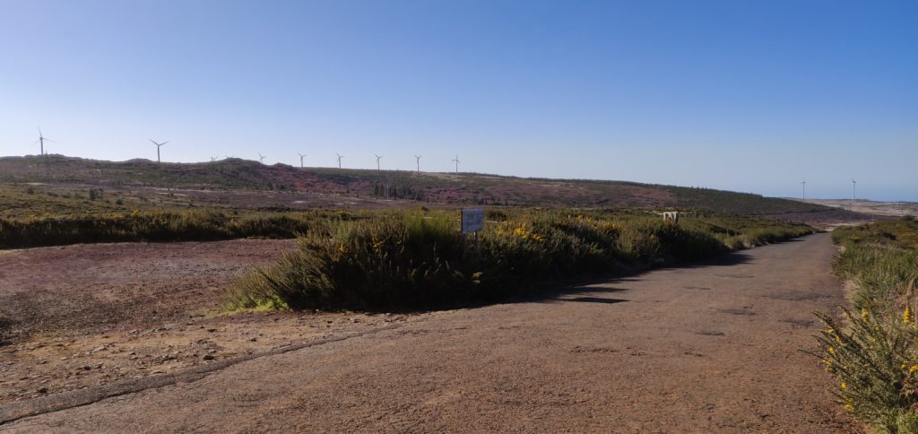
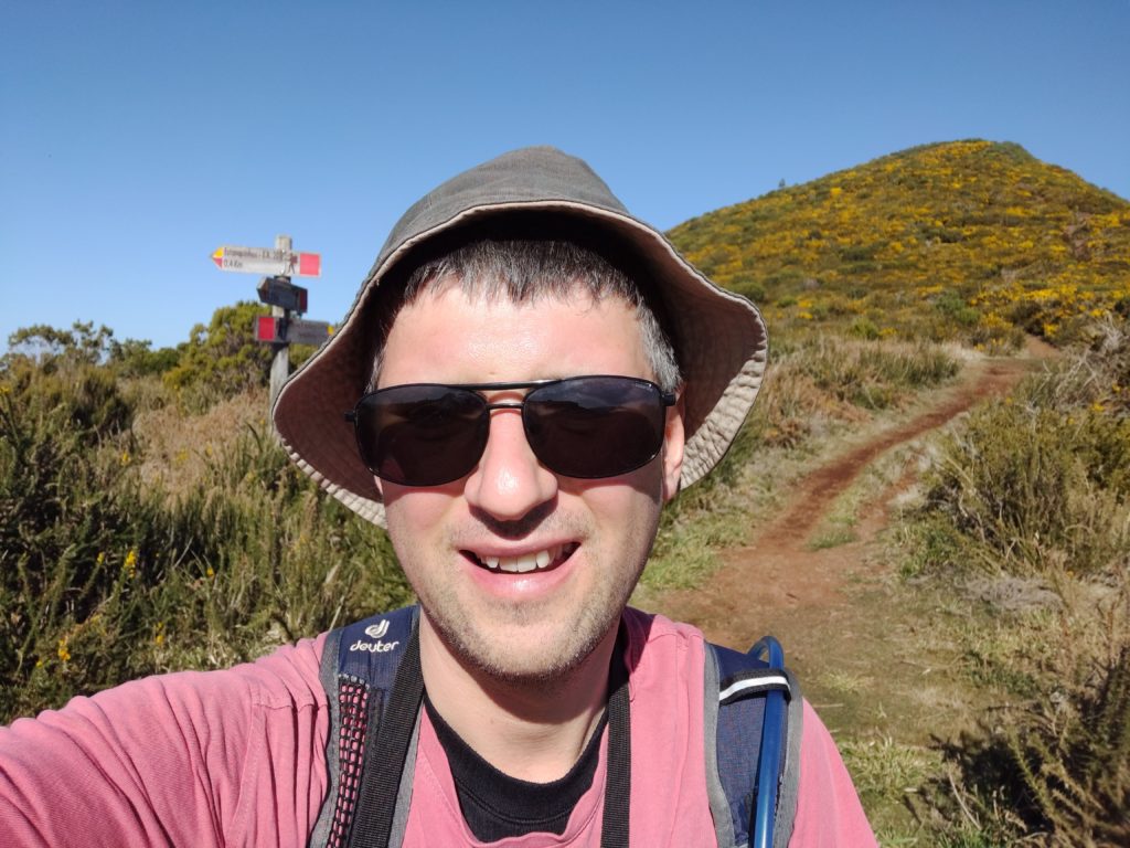
From the carpark, the walk is a fairly simple matter of following the obvious path, which starts on the opposite side of the road, up to the summit. The ascent took me 40 minutes (partly as I had to wait for my parents, who are somewhat older) and about 20 minutes down. The path is almost exactly a kilometre in length for 130m ascent, the steepest bit coming just before the summit, but at no point is it hard. On the top, there’s a fairly large area of flat ground where you can set up, which has wooden fencing around it – perfect for attaching a SOTA pole with bungees!
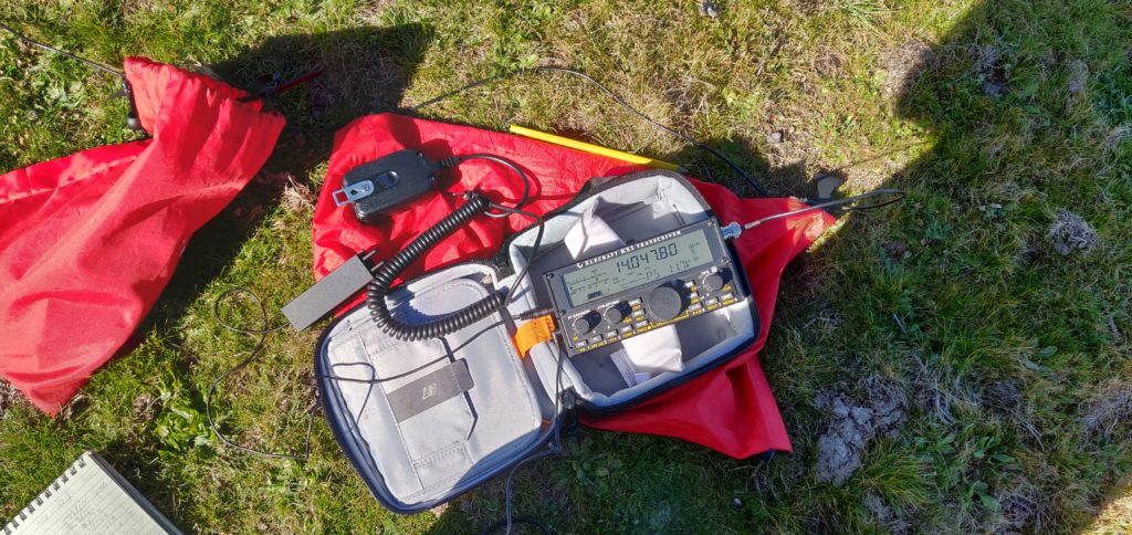
I set up on 20m CW and fairly quickly had made 7 QSOs, enough to qualify the hill.
This was a lovely start to the activation, and a fairly enjoyable easy hill.
Total climbing: 135 m
Total time: 01:01:00
Pico Chao dos Terreiros (CT3/MI-008)
Update February 2020: I returned to this hill a year after writing this post and a lot had changed. At Boca de Corrida, the path had a chain and padlock across it and there were no indications as to whether only vehicle movement is restricted, or whether pedestrians should keep out too. The latest satellite imagery shows that the clearance I witnessed in 2019 had been extended and there is now a maze of paths in place of the old track. Given this exploitation, I decided to head north on the steep, paved path signposted to Encumeada. OpenStreetMap indicated that this would be a useful diversion, and that it is possible to turn left at around 32.7253N, 16.9938W along a track to bring you back towards Terreiros. I couldn’t see the track at this location however – I suspect it has become overgrown. With my parents in tow and nowhere else to leave them, I abandoned my trip in 2020. I suspect next time, I’d approach from Fontes, to the west, even though the route is longer and steeper. Anyway, back to 2019…
On the map, Terreiros (4 points) is not far from Pico Ruivo do Paul but the geography of the island means it’s a pretty decent drive between the two places. To make the most of the day, we drove from Pico Ruivo do Paul to the ‘skywalk’ at Cabo Girão (a glass platform overhanging the cliff), where we had lunch at the café, before heading up to Terreiros. A tip for anyone following our route: use the toilets at the café before eating – the €0.50 you pay for the toilets can be discounted against your café order. Not knowing this, we did everything in the wrong order.
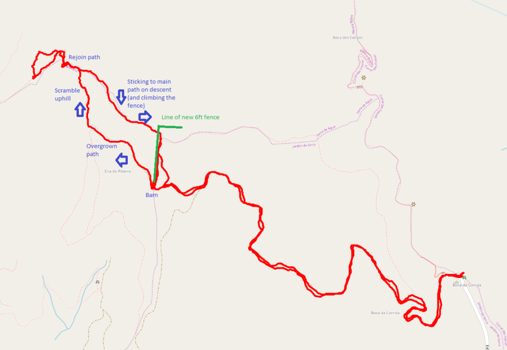
The drive to Terreiros from Cabo Girão looks really bad on the map but it’s actually fine and my TomTom got us there fine. The path starts from the end of the road at Boca da Corrida, where there’s a small car park and chapel (32.7110N, 16.9869W). At least on the map, the path is, again, obvious and wide and twists its way around the hill over the course of about 2.7km. The ascent is about 200m. It was easy enough for my parents to do with me for the first about three quarters of the walk. One note on my map indicated the path was overgrown and impassable. That was definitely not the case and in fact there were people working clearing trees on the hillside above us. And then I had a problem. At the barn at 32.7139N, 16.9970W the path divides and it isn’t clear what you are meant to do. The track continues up a steep hill, with a newly made fence on your left, but when you get to the top, you realise you need to be on the other side of the very tall (maybe 6ft) chicken wire fence. But there’s no major path from the barn on the other side of the fence. Yes, the fence has been built right across the path. It had taken me 40 minutes to get this far, and I wasn’t proposing to give up, so I left my parents somewhere safe and set out to find my own path, keeping the new fence on my right. This was a mistake. It involved fighting through some very overgrown plants, and then scrambling up a steep grassy bank with plenty of opportunity to lose your footing. It was really hard work. After maybe 15 minutes of this, I eventually came out to the path I should have been on, and continued to the summit.
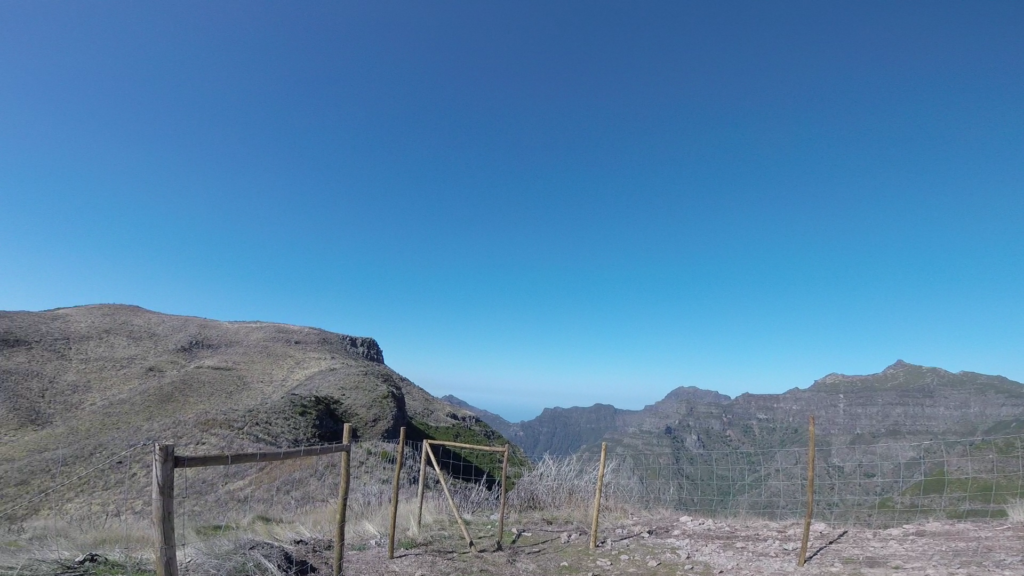
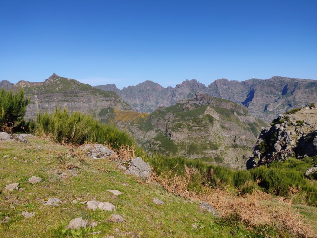
The activation zone of Terreiros is nice and large and, again, this isn’t a well-frequented hill, so it was nice and quiet. The view is also spectacular. I made 10 QSOs from here, including two Americans which was a nice surprise for 10W into a simple linked dipole.
On the way back, I stuck to the path and managed to climb over the fence, rather than taking the ‘cross country’ route I had used on the ascent. This turned out to be much better. The descent, including recovering my parents from where I had left them, took just about 35 minutes.
Total climbing: 530 m
Total time: 02:46:32
One word about the journey back to Funchal – G4OBK has mentioned how useless his TomTom was on Madeira. I didn’t have as many problems as he seemed to have but the journey back was an exception, with it continually insisting I needed to take very minor one-way streets down steep hills that were about the same width as the car. No damage was done, but it wasn’t the easiest driving.
The next day, it was on to the next two hills: Pico Ruivo and Arieiro.


Pingback: 3 days of SOTA in Madeira – Day 2: Pico Ruivo and Pico Arieiro | Dom Smith